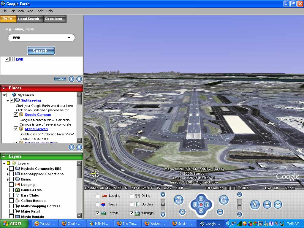
Want to simulate a plane landing at the Newark Liberty International Airport??
Follow these simple steps:
1) Download Google Earth.
2) In the search bar punch in 'EWR'. Which is the airport code for Newark Airport.
3) Once your view zooms in to the street level of the airport, look for the runway (slightly north of the terminals)
4) Shift the view using <> arrows to get the runway at the center.
5) Using the tilt function, tilt your angular view to something like 15 degrees from ground level.
6) Zoom out your view till the altitude reaches 36,000 feet.(Usual flying height of passenger airplanes)
7) And now, you are all set to land!...Begin zooming in towards the airport till you zoom in close enough to touch the runway...Don't you feel like a pilot?


No comments:
Post a Comment